As many readers know, I really love to hike. It’s relaxing and connects me to nature. I particular enjoy mountainous, or at least hilly, routes to get the legs stronger and the heart pumping. Sometimes I hike solo, but I particularly like to hike with a group for the socialization. And hikes and walks help me ponder and solve problems. As a Stoic might say, “Walks are a kind of magic. They clear your head. They calm your nerves. They pull you away from distractions. Seneca said the mind must be given over to wandering walks, and so too must you.” (https://dailystoic.com/it-is-solved-by-walking/)
Hikes around Asheville are of a different type than those around Prague, but I find both types to be quite satisfying and rewarding, and I leverage Meetup to find fellow wanderers to join on excursions. And while exploring the trails around Prague, I have of course leveraged Czech hiking trail markers.
According to the Wikipedia entry:
The Czech Hiking Markers Standard is an international system of hiking markers for tourist trails, used in more countries than any competing standard. The signs and markers can be used in both wilderness and cities. They are internationally well understandable as they grow from the same tradition in other Central European countries. Similar signs are in use in Austria, Germany, Poland and Switzerland.
The system is also in use elsewhere in many other nations all around the world, often because of Czech volunteers. I’ll be hiking in the country of Georgia next month, so I look forward to seeing if I spot Czech-style trail markers there. I definitely expect to when hiking in Slovakia’s High Tatras mountains in October.
Czechia itself has reportedly been using this helpful trail-marking system from the Czech Hiking Club since 1888, and there are now over 70,000 km (43,500 miles) of hiking trails which have been marked in this way just in this one country! One would never run out of new trails to try.
While I’m used to trail blazes painted or affixed to trees, posts, large rocks, etc in Western North Carolina (WNC), there isn’t a consistent pattern or approach, with shapes and colors differing per trail, including even within one system like in Montreat. And NC’s Mountains-to-Sea Trail (MST) uses a 3-inch (7.2-cm) white circle marker which can look very similar to a common lichen which often grows on trees in the region, causing me confusion multiple times.
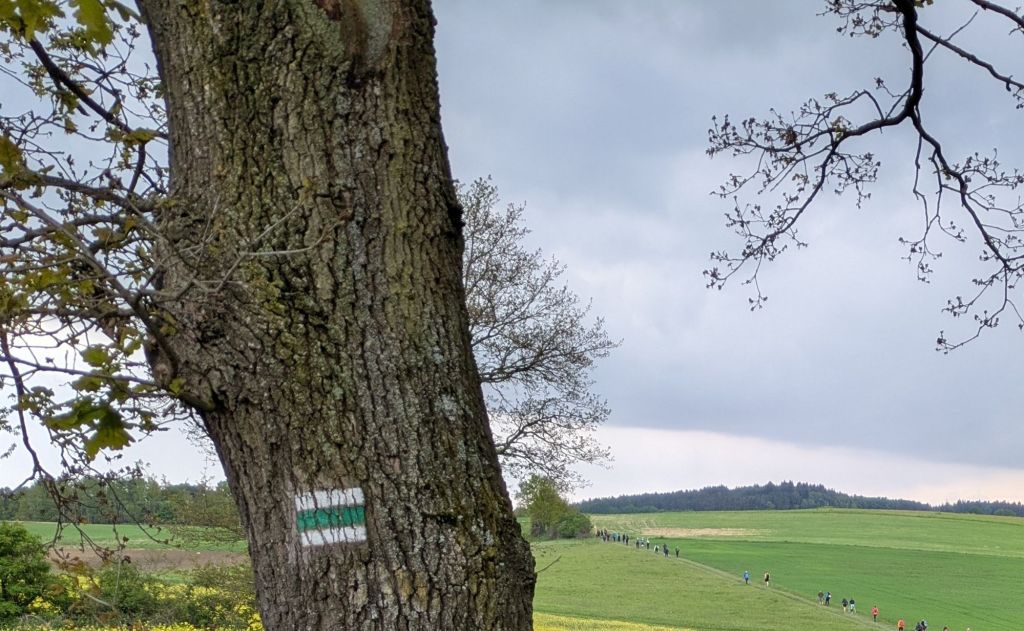
But the Czech system uses markers which while not distinct for any particular trail, provide for a sort of standardization which helps hikers readily understand which route they’re likely taking. Each trail is marked with a color painted between white lines for visibility, with the particular color given for a specific trail. The color is painted as a line or as an arrow for turns. A feature of the system is that it is simple to mark objects along a trail, with volunteers using sheet metal or cardboard matrices to keep the signs uniform in size at 10x10cm (4″x4″) square. I once saw a guy painting a new marker onto a pole in the middle of a small Czech town.
As for the color-coding:
– red indicates the most difficult or summit trails
– blue is used for “significant” trails
– green denotes shorter local trails
– yellow is leveraged for short interconnecting trails
I’m not sure exactly how one distinguishes some of these differences, which seemingly could be minute. But anyway, the excellent Mapy mapping phone app, another great example of strong Czech mobile apps, includes the trail marker colors for reference, like around Liberec where I recently joined a group hike:
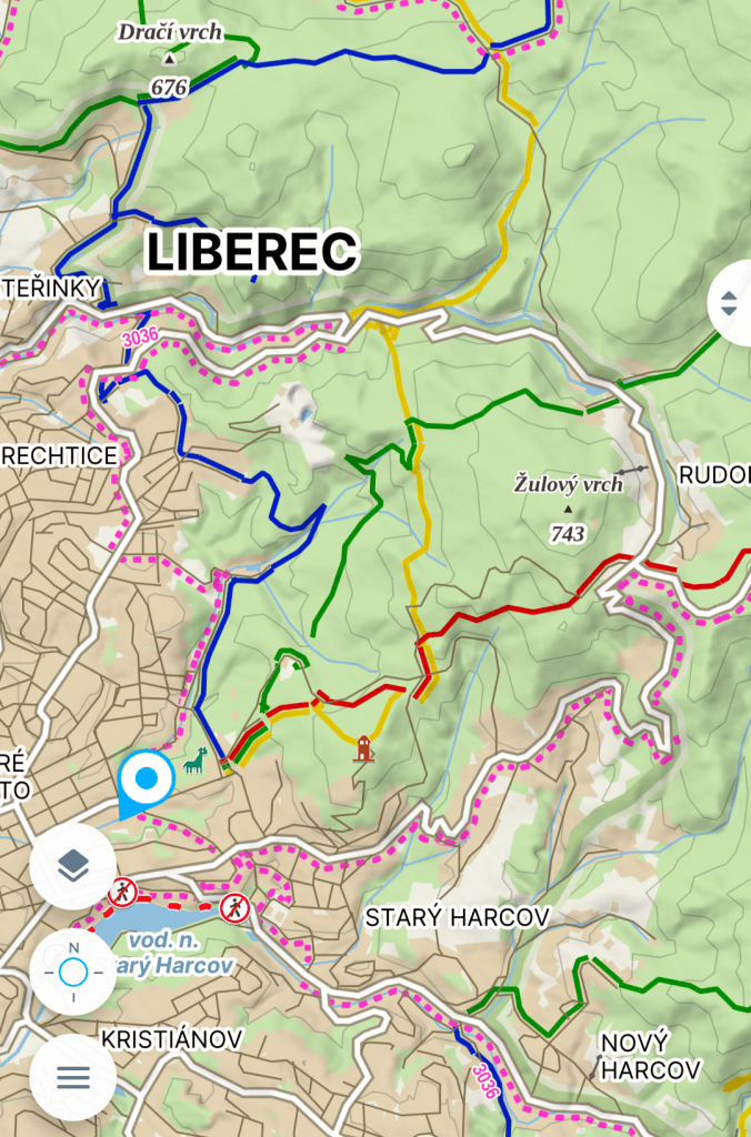
And I’ve seen all four of these colors on hikes. Typically when hiking with a group we’re just following the red route the entire time because we’re heading up to a popular summit destination. However, during the 74-km Prague to Prčice march in May, we thousands of hikers often used “side” trails like this green-blazed path seen below (zoom in to the distance to see a “few” of our fellow hikers).
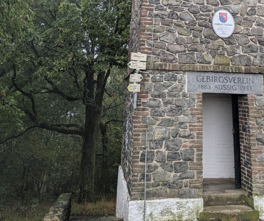
Not only are there the markers like the one above, but it is quite common to also have directional signage at intersections, which will include destination info, trail marker colors, and distances helpfully provided. It’s a remarkably well-labeled solution, making it tricky to get lost in this country, methinks.
The hodgepodge trail-marking approach in Western NC has its advantages, and I really do like the varied distinctions between trail markers in the Montreat system, but there is something to be said for the simplicity of the official Czech system as well.
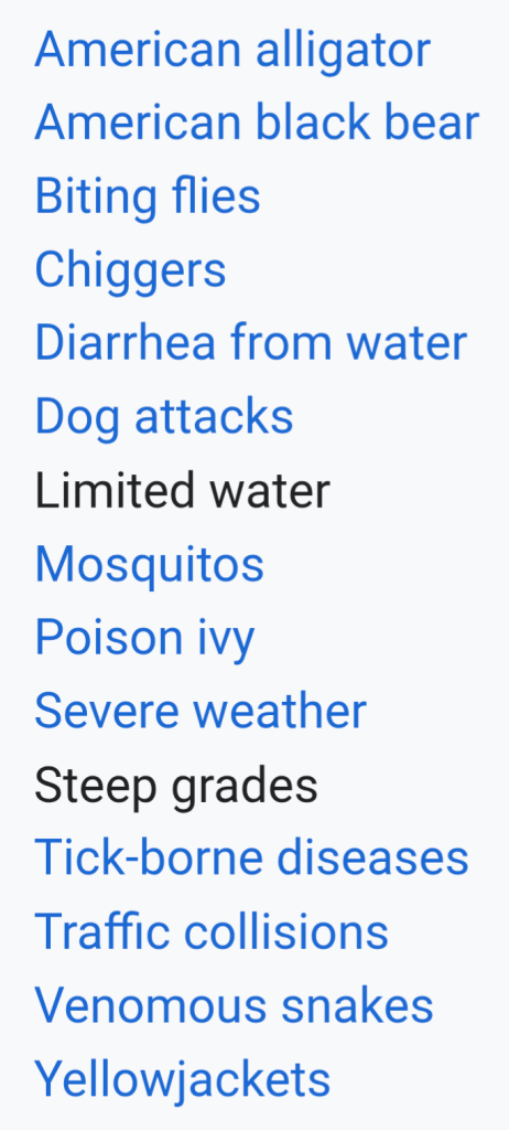
As a side note, I’ve been joking with both my Asheville and Prague hiking buddies that while one must be on the lookout for various risks when hiking in WNC, such as bears, rattlesnakes, yellow jackets, poison ivy, and ticks, the hikes in Prague typically involve just wondering if there’s a pub at the hike’s summit! 😂 That said, while poison ivy is endemic to North America, ticks and Lyme disease are an issue in Czechia too, unfortunately. Here’s a list that Wikipedia provides regarding risks one might encounter on the Mountains-to-Sea Trail, helpfully dissuading many from partaking in a hike:
Today’s side notes:
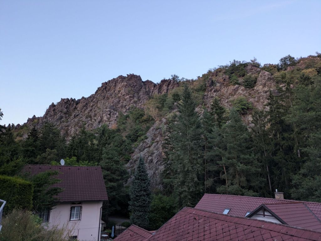
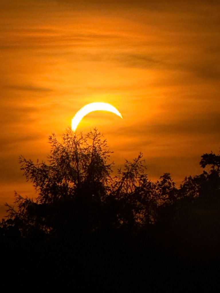
Early on during this latest visit to Prague, there was a partial solar eclipse event in the region. I joined our Prague Social Runners group for a jog through Divoká Šárka, an expansive and lovely park on the outskirts of the city not far from the airport. There are big cliffs there, and we ran up to one as the sun was setting and also being partially obscured by the passing moon. It’s always a remarkable realization that the sun and moon coincidentally(?) look to be about the same size from our perspective. We managed to capture a few good photos of the phenomenon, including one with a weird green optical lens reflection effect when the actual sun saturated the sensors. Great fun!

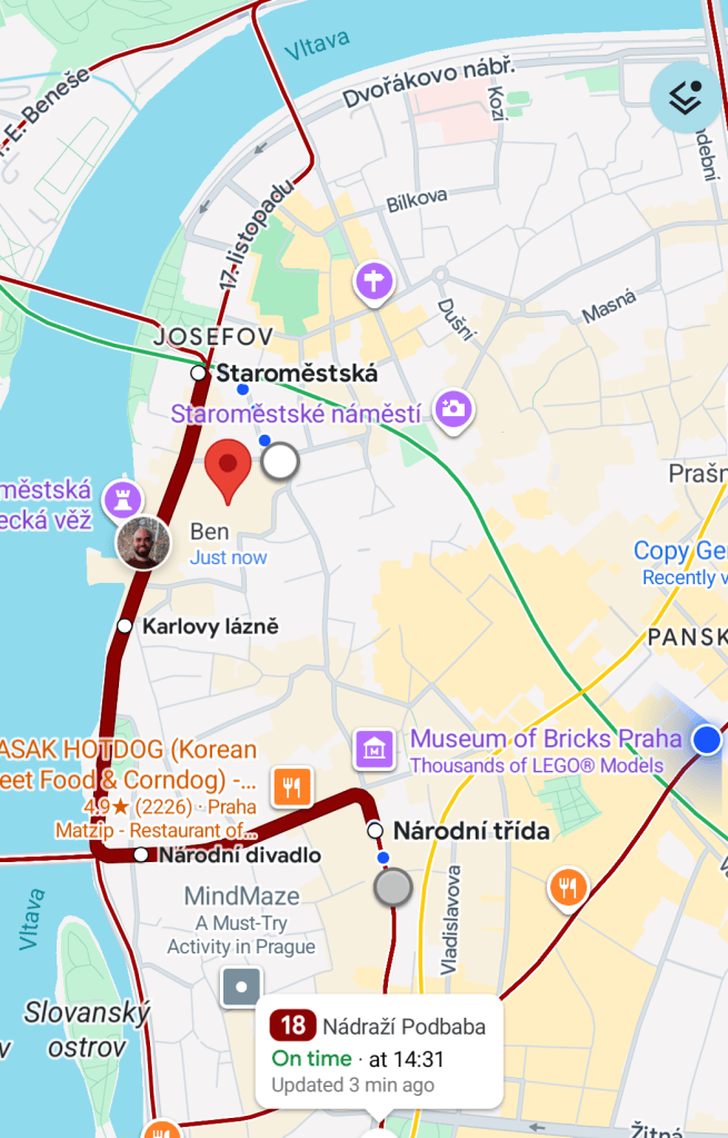
I am grateful for Ben’s recent Prague visit, which began just a couple of days after the eclipse. One day we were both in the heart of the city doing separate things, but we communicated that we wanted to meet up. But instead of setting a time and place, I told him to share his location through Google Maps, and to then just go wherever he wanted, as long as it was on foot, and I would try to find him in person. It was quite fun! I jumped on one tram and headed in his direction, but about halfway towards where he had been, he had moved so far that I decided that I needed a better path, so I looked at various tram routes from where I was heading, and accordingly hopped off the original tram and jogged to catch a different tram whose trajectory was more in Ben’s direction. There was often a two-minute delay in the presentation of where he was, which can be significant given his long legs and associated pace. But eventually I found him approaching me (unintentionally of course), and luckily his height made him simpler to spot, haha.
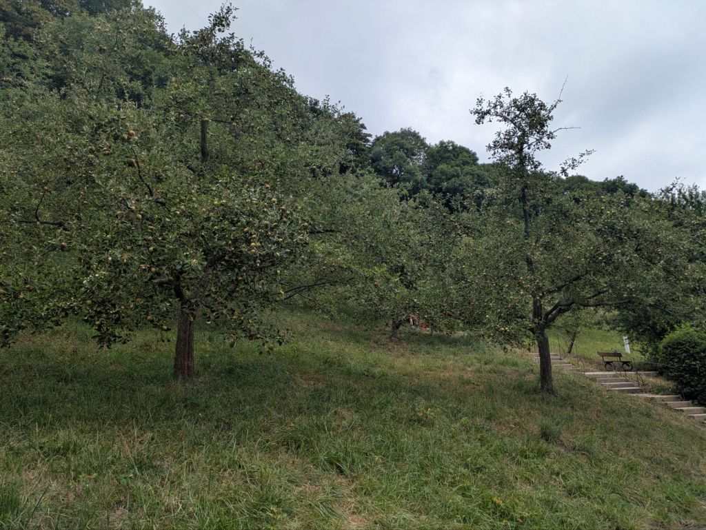
During Ben’s stay, Prague finally got some long-needed rain and cooler weather. Until then the humidity had normally been between 35-50%, and it was so freakishly dry. We were in severe drought conditions, and boy was it brown around here instead of green. But fortunately Prague’s great public orchards on the side of Petřín hill had survived the long-term lack of water, and Ben’s visit timing coincided with the ripeness of the various apple trees on the hillside. I’m continually impressed by the quantity and quality of the organic trees in the orchards, which aren’t limited to bearing apple fruits, but also include various types of pears, cherries, and plums. One can freely pick and eat whatever you want. I’m surprised that no one seems to pick massive quantities and then sell the fruits at a market. Prague apparently has the most public orchards in the world! (https://www.prague.fm/248005/70-surprising-gems-await-in-prague/)
Today’s dad joke:
On the tall mountain I thought I’d found a good hiking trail. But alas, it was more like a hiking trial, and the evidence against me was steep.
Today’s Stoic quote:
Sometimes Stoicism can seem overly passive, so I respect how popular American author and podcaster Mel Robbins does a good job at closing the loop. In summary, she says “Let them, and then let me.” So, for example, let someone else have their opinion about you or react in a certain way to an action you’ve taken. Let them. Then, in follow-up, let me decide what, if anything, I want to do. You can’t change someone else – they must change themselves. And only you can truly change yourself.


“Hiking trial” is chef’s kiss.
😄